|
||||||||||
 |
||||||||||
|
||||||||||
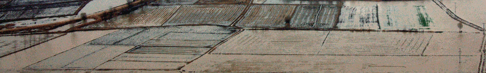
WP 202: Winds, waves and storm surgesThe main source of information about historical weather phenomena and processes are the reanalyses performed by the European Centre for Medium range Weather Forecast - ECMWF (Reading) as with the use of the most up to date data assimilation system analyses are carried out of all available historical data for the given time period. The data from these reanalyses are at every six hours with a spatial step from 50 to 70 km. In this form these data are not suitable for evaluation of meteorological parameters leading to extreme events such as storms, sea level variations, and the related adverse effects. It should be stressed that in a grid with a step of 50 km one of the major climate forming factors, such as Stara Planina mountain chain disappears from the landscape of Bulgaria. This requires the use of a special procedure for the transition to a finer spatial grid and smaller time intervals, which is called "downscaling". Downscaling of the reanalysis of meteorological observations plays a crucial role not only for the correct representation of past events (extreme storms, etc.) but also for the reliability of the climate models predictions. The spatial resolution plays a very important role to minimize the errors, to correctly represent the topography in the models and is especially important for the successful identification of the vulnerable areas at a regional scale—actually it is impossible to identify and assess the change in the vulnerability of such areas without that approach. Eventhough the downscaling, proposed in the framework of this project, targets the study of risks of extreme winds and dangerous coastal events for France and Bulgaria, the results are of significant importance at European level, because of the further usage of the results and the methodology for other European areas. While for France a good solution could be the use of the global model ARPEGE with its stretch geometry, for the region of Bulgaria definitely better results are expected from the use of the regional model for weather forecast ALADIN. 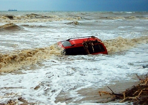
Irakli, Bulgaria 2007 Simulation of historical storm situations is a key tool in examining potential coastal hazards. An important tool in the management of episodic extreme events is a reliable forecasting/hindcasting capability, because model data are the only datasets with complete coverage in space and time. WAVEWATCH III and SWAN wave models will be used for the hindcast study in the frame of IncREO Project, in order to identify the hazard zones (strong winds and high waves) along the Bulgarian coastal zone. The activities of the marine team of NIMH-BAS will include the choice of historical storm situations in the western part of the Black Sea, validation of the numerical models, using the altimeter data from Envisat, Jason-1 and Jason-2 satellites, simulations of sufficient number of past storms (hindcast) in order to provide an up to date identification of the marine hazards for the Bulgarian coastal zone using the high resolution wind fields from the downscaling procedure and the progress in remote sensing technologies. |
||||||||||
| Web design: Minka Stoyanova, Tsanka Mladenova | ||||||||||